

The Role of Geospatial Technologies in Railways Asset Management
The distressing COVID-19 pandemic and India’s stringent lockdown, saw the Indian Railways emerge as a beacon of hope. Through a three-pronged approach, the national transportation lifeline helped sustain essential logistics management, transportation of migrant workers through “Shramik” trains, and setting up of isolation coaches for treating mild, non-intensive care patients, in a bid to meet the nationwide shortage of hospital beds and equipment.
The Indian Railways is among the world’s largest rail networks, with its route length spread over a massive 67,956 km. Boasting over 13,169 passenger and 8479 freight trains, the world’s largest railway system under single management plies 23 million travellers and 3 million tonnes of freight daily. Covering around 4.31 lakh hectares of land with 52,000 land plans, the Indian Railways interconnects 7349 stations in the country as of now.
With such wide spatial coverage spanning the length and breadth of the country, the Indian Railways has traditionally required enormous manpower, capital and energy for asset management. In recent years, however, geospatial technologies in the form of Geographical Information Systems (GIS), Remote Sensing, Drones based and LiDAR surveys, 3D data generation, and so on, have emerged as a more efficient alternative, enable precision data storage and application for handling the critical aspects of railway infrastructure systems in India.
What makes Geospatial Technology relevant for Railways Asset Management?
The Indian Railways represents one of the largest and most critical infrastructure investments for India, the efficiency of which is affected by any discrepancies in safety in the form of natural or human-made disasters or accidents. At the same time, operational efficacy is dictated by parameters of speed, the extent of automation, data transmission, timely monitoring, and so on.
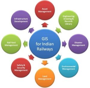
GIS for Indian Railways; Source
Geospatial technologies help leverage the power of image and data management along with multi-pronged analytics to extract contextual information on railway infrastructure and operations. With an unmatched reach at much-reduced costs, geospatial technologies can be used to extract assets along rail corridors and monitor them reliably at regular intervals despite inhibitions of terrain or hazard.
Mr Anisur Rehman, Chief Engineer of the Northern Railways, elaborates on this perspective in the recent AGI Webinar, “GIS Technology is an extremely powerful technology which can help shape various operational requirements and asset management of the Indian Railways… We are trying to use geo-enablement projects for asset management, decision-making and planning, disaster management and rescue operations, monitoring and alert systems, real-time tracking and prediction or forecasts, as and when we have fully developed our asset capturing capability.”
Work in Progress: GIS-Based Railway Assets Database Creation
The Indian Railways is mapping the entire railway asset infrastructure in the country in two phases – the first encompasses the mapping of the entire track network in the country along with other assets along the tracks, while the second involves real-time tracking of trains using NavIC devices. From identifying encroachments to dictating future planning exercises, gap analysis to passenger and freight analysis and prediction, the use of geospatial technologies holds tremendous potential for Indian Railways.
Track and Related Assets Inspection
Recent improvements in GIS technology have enabled instant storage of field data onto a central GIS data store through server-based applications. These new geospatial tools can be perceived as a wealth of free online map data, including railway tracks and related assets near them, such as bridges, tunnels, level crossing, and so on.
Saranya M, a Senior Analyst at ESRI India, highlights the importance of improved GIS Field Apps for Asset Inspection at the AGI Webinar in the following words: “Ideally, no matter which industry we are working in, some amount of field activity is absolutely necessary. In traditional pen-and-paper systems, where we have to write down every detail of the inspection and then feed it manually onto the server, the process is time-consuming and has room for lots of error.”
“We can reduce these discrepancies and improve our efficiencies using GIS-based mobile apps or field apps. Options such as form-based applications and map-based applications are available… These apps can help you navigate to the particular location and provide you with simple tools to digitize on the field itself.”
Communication and Signalling Networks
Instead of the tedious process of going through various hard-copy diagrams of cable plans, cable route plans, signalling plans and rule diagrams every time a cable, signal or asset goes faulty, railway crews can leverage a spatial asset management system that converts paper drawings into intelligent digital drawings.
Not just the component of safety, but also those of reduced expenses, improved services and homogenous access to resources are highlighted with the use of such efficient tools. For instance, WTI’s Railway Signalling and Telecom Information System (RastIS) caters to the requirements of the cable management department of the Indian Railways.
The tool converts cable, route and signalling plans along with location & power supply diagrams, track bonding & SWR documents into an intelligent database with relevant spatial context using a customised spatial information system. Developed using ESRI Map Objects, VB.Net and MS-Access on a three-tier architecture, RastIS addresses the day-to-day needs on information on railway communication and signalling networks, which can be directly used by crews for maintenance operations and identification of faulty assets.
Electric Power Distribution Networks
Electric utility components in critical transportation infrastructure such as Indian Railways are realizing the myriad benefits of geospatial technology for effective distribution and tracking. Dedicated power departments in the Indian Railways are expected to keep a tab on various electrical facilities, such as poles, circuits, power lines and transformers. This information can be better collated and organised using GIS, linking the database to an output map for easier analysis and faster decision-making.
GIS-based mapping of the electricity distribution facilities in the study area can be overlapped with multiple related layers of existing distribution networks, gap analysis and faults or patterns. The process begins with a high-resolution base map, which is refreshed frequently to enable accurate monitoring of field conditions.
Maxar Technologies Manager – Sales Engineering Asia Pacific, Mr Shailesh Shankar, elaborated on this aspect. “You can plot all your assets onto a base map, which keeps refreshing on a yearly basis. We have been able to create a technology that will enhance your traditional 30-centimetre imagery to 15-centimetre pixels, or 50-centimetre imagery to 30-centimetre pixels.” Data from GPS collection points along with non-spatial data such as electrical network and transformer details can be superimposed on the high-resolution base map for creating a detailed model of a database.
Rolling Stock Management
Geospatial technologies have great potential when it comes to improving rolling stock management efficiency for locomotive health and well-being along with shipment and asset tracking. With the help of cost-effective and reliable wireless data transmission and GPS devices, authorities can collect relevant real-time information even in the absence of instantaneously loading digital maps.
At the same time, geospatial technologies also enable statistical analysis of rail freight transportation by identifying the origin and destination matrices and commodity flows. With much fewer efforts in comparison to manual surveys, geospatial data enables query analyses of desired regions on the map, transforming statistical data into a visual/map-based perspective for easier interpretation.
Land Management
From aerial surveys of railway stations to GIS mapping of vacant land plots, the Indian Railways is using state-of-the-art geospatial technologies for land asset and project management through web-based applications. Mapping fixed asset such as land is a critical resource that can shape any future undertakings, and the usage of GIS-enabled aerial surveys help secure imagery of projects at a scale that is not possible manually.
The Delhi Metro Rail Corporation is spearheading the use of geospatial technologies for effective monitoring of their assets through drone surveys and GPS systems. Aerial surveys undertaken by DMRC aims at producing relevant civil outputs in the form of orthomosaics images, point clouds, 3D models and ECW files. Such data enables scientific conclusions for expansion or reconfiguration of railway stations, lines and related assets.
“The methodology described in the tender comprised digitisation of land records available with DMRC for comparison with aerial survey data, on-site measurement of land plots wherever necessary, demarcation of current DMRC boundaries on drawings & calculation of plot areas, and thereafter reporting encroachments in drawing and tabulated form,” Dr. (Ar.) Namrita Kalsi, Joint General Manager (Architecture) & Property Development at DMRC shared with AGI.
Timely Disaster Response and Management
Such detailed railways asset management using geospatial technologies also helps attend to critical elements in disaster management and rescue planning. Geospatial technology can be used to collate details such as broken ties, missing fasteners, and so on, which tend to go unnoticed by the human eye. At the same time, GIS can facilitate the faster location of accident sites and accessibility information.
A geospatial database with complete information on critical facilities such as hospitals, fire stations, police stations superimposed with real-time location information of trains can prove to be immensely beneficial in terms of safety and disaster response. From sending out warnings at unmanned level crossings to rectifying problem areas in time to prevent mishaps, geospatial intelligence can also help in incident tracking, access & response management and risk assessment in a particular region.
The Way Ahead: Geospatial Holds Tremendous Potential
To support the intentions of the Indian Railways in ensuring the safety, maintenance and upkeep of their vast assets, including railway tracks, signalling systems, locomotives, wagons, coaching stock and stations, several path-breaking technology providers and data enthusiasts are coming up with valuable solutions and insights for better resource utilization. This is another reason behind the India Railways entering into several contracts with private providers of geospatial services.
Several interesting projects, such as 3D mapping of stations to enable passengers to locate any services at the station easily, or real-time location intelligence for rolling stock using NavIC is already underway. It is encouraging to note that government authorities think tanks and private players are coming together to develop geospatial intelligence-based support infrastructure to enable efficient railways asset management for improved safety, reduced delays and bottlenecks and optimum resource utilisation.


Comments on Post (1)
Pingback : 2sulphide