Geospatial Technology Applications in Defence and Security
The war landscape is changing, thanks to the avalanche of technological advancements. Defence and security concerns have evolved from traditional armed conflicts to new and evolving tactics, hi-tech weaponry and even ‘virtual’ warfare.
A seamless flow of accurate information in pre-, real-time, and post-combat scenarios is of absolute importance among ground defence, intelligence and law enforcement organizations. Precise, location-specific information about activities, objects and places of interest is key to arriving at quick decisions for operational orders and field action. Geospatial technologies and tools hold immense significance in this regard.
Integration of C4ISR with Geospatial Intelligence
C4ISR (Command, Control, Communications, Computers, Intelligence, Surveillance and Reconnaissance) acts as the central nervous system of militaries and national security agencies around the word. It relies on an interoperable, secure, enterprise-class spatial infrastructure powered by Geospatial intelligence and analytics.
Massive volumes of Geospatial information from high-resolution satellite imagery, aerial captures from manned and unmanned aerial vehicles (UAVs/Drones), remote sensing, positioning systems, along with non-spatial data references such as photographs, documents and work orders are being integrated and transformed into actionable intelligence using GIS.
Such integration of imagery and geospatial capabilities in support of a nation’s defence and intelligence needs is termed as Geospatial Intelligence (GEOINT) – a critical aspect of C4ISR and an emerging pillar of strength behind a wide variety of national security mission applications.
Applications of Geospatial Technologies in Defence and Security
Situational Awareness
The advent of modern Geospatial technology has enabled intelligence units to acquire high-resolution satellite data for monitoring activities of enemies and allies. This, combined with continuous remote sensing data, information obtained from UAVs or ground-based sensors and manual observations can be realistically presented in two and three dimensions on GIS applications. Commanders, personnel and surveillance teams can access minute environmental details at all times and confidently take quick decisions during unfavorable circumstances.
Military Operations
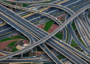
Military organizations can benefit from routing, filtering, analysis, and visualization of spatial data on enemy activities during regional conflicts or rapid deployments. Geospatial technologies are being used to simulate battlefields on screen for advanced analysis and planning. Points of interest and potential targets can be surveyed remotely to accurately map ingress, egress, utility junctions, functional zones, and deployment locations.
Land: Getting prior insights on the war terrain can help optimize resource utilization. For instance, data on land elevation, vegetation cover, land use, road networks, communication lines, nearby habitats and adverse physical features can guide the transportation and positioning of weapons, carriers, and vehicles beforehand. Placement, concealment and camouflage of troops along with other tactical communication setups can be realized with greater accuracy.
Water: With naval vessels compelled to navigate through waters without any visual aids, global positioning system (GPS) technology proves immensely useful for determining geographic positions at sea. Modern tools have facilitated greater accuracy in this regard. Complex natural features such as ocean currents, wave conditions, sea surface temperatures and tides can be studied in detail using Geospatial Information Systems, and then used as an advantage instead of a deterrent in naval operations.
Air: Battle environments involving air operations require precise spatial information for navigation, besides insights on the target location, proximity of civilian areas, terrain features and weather conditions. Geospatial information can fuel virtual reality for simulating ‘boot camp’ experiences for fighter aircraft pilots for quick adaptation before an operation.
Indoor Navigation and Positioning
A major reason why the 2008 Mumbai terror attacks could not be thwarted faster was that security teams needed live indoor maps of the sieged buildings, such as the Taj Hotel, but they were not available. Real-time insights using indoor positioning to identify location of people or assets within a facility can prove critical during such security breaches.
Movement of security personnel can be monitored and guided in real-time, adding an extra layer of supervision during emergencies. Virtual perimeters called ‘geofences’ can be created to guard off high-security areas within open facilities and breaches by unauthorized people, objects or equipment can be automatically notified to security personnel.
Logistics Management
Using Geospatial information to determine optimal routes for convoys can help forces gauge disruptions due to mishaps, traffic jams, unfavorable geographies, and more. Unfavorable terrains and circumstances make manual surveys and supervision nearly impossible.
Geospatial tools and technologies such as IoT sensors, automated drones, and GPS can emerge to the rescue for regular monitoring of routes, tracks, tunnels, and so on. Real-time position of vehicles/cargo can be mapped, along with military bases, conflict areas, residential units, enemy positions, etc.
Real-Time Weather Information
Field commanders, whether on land, in air, or at sea, must have real-time weather information at hand regarding cloud coverage, wind/rain conditions, visibility, extreme weather events, and more. Geospatial technology can be used to collect, reformat, store, update, manipulate and consolidate weather and landscape data for clear visualization, prediction, and real-time decision support.
Cybersecurity
Cyberattacks have become a major concern for governments across the world as terrorism and warfare have gone online. Even small-scale cyberattacks are costing the global economy trillions every year. Besides, with self-driving vehicles and cashless finance populating the coming years, rapid increase in IoT products, smart cities, and infrastructure, the geographical aspect of cybersecurity has become more important than ever.
Geospatial intelligence used in conjunction with cybersecurity can help ensure that critical infrastructures and data networks like those listed above remain safe. Authorities can pinpoint sources of cyberattacks using spatial analytics to include mappable and traceable physical locations in the digital sphere. GIS can help them comprehensively view multiple interconnected or discrete factors to determine attack source, impact and response. Geospatial can be used together with Blockchain, AI and ML for decentralization, predictions and preemptive defence.
National security agencies already rely on Geospatial data for emergency management, national intelligence, infrastructure protection, and defence platforms. Geofences are being created in the form of whitelisted zones in offices or IP addresses, all locations beyond which are blacklisted and restricted. This helps monitor and flag alerts much faster.
Defence Estate Management
Military bases and defence estates require significant efforts and costs for effective management. GIS can be used to address this challenge with data-driven, single point maintenance and tracking of all base stores/functions. Changes can be updated and communicated in real-time on the GIS platform, which also visualizes raw data as readable maps and figures. More importantly, GIS can support analytical tasks for key decisions.
Data on historical land sales and purchases, potential impact of military activities and installations on the immediate environment, location of supply depots and communication infrastructure, terrain conditions, lines of sight, and so on can be factored in for decisions compliant with environmental and economic resource management.
The Rising Importance of Geospatial for Defence & Security
The Union Budget 2022 has allocated INR 5.25 lakh crore for Defence, the highest among all ministries. At the recently hosted post-Budget webinar on Defence, Hon’ble Prime Minister Narendra Modi talked about a blueprint for developing a vibrant ecosystem of research, design and development . “The more we deploy our formidable technological power in defence, the more confident we will be regarding our security.”
The signing of the Basic Exchange and Cooperation Agreement for Geospatial Cooperation (BECA) between India and the USA in 2020 was also on these lines, enabling India to access advanced satellite imagery, topographical and aeronautical digital data in real-time from the US.

BECA Agreement Geospatial
The government is keenly recognizing the efficiency of Geospatial technology and intelligence in defence and security. It is now time for more indigenous developments and research take place in the field. Advanced technologies such as AI, ML, AR, and Advanced Computing should be used together with Geospatial for more innovative applications.