

Harnessing Geospatial Tools for Disaster-Resilient Infrastructure in the Himalayas
The Indian Himalayan Region (IHR) is one of the most awe-inspiring and ecologically significant areas in the country. Spanning 13 Indian states and union territories and home to over 50 million people, the Himalayas are as fragile as they are beautiful. Frequent landslides, earthquakes, flash floods, and glacial lake outburst floods (GLOFs) often disrupt road networks, damage public infrastructure, and cut off entire communities. In such challenging terrain, geospatial technologies are becoming essential tools in designing safer, smarter, and more resilient infrastructure.
Understanding the Risk Landscape
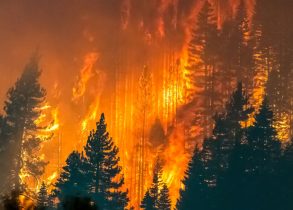
The Himalayan region falls largely in Seismic Zones IV and V, making it one of the most earthquake-prone areas globally. According to the Geological Survey of India, about 15% of India is prone to landslides, and much of that lies in the Himalayas. Climate change is also accelerating glacial melt, which increases the risk of GLOFs. For instance, in 2023, the South Lhonak Lake in Sikkim burst, causing devastating floods that damaged hydropower infrastructure and took more than 40 lives. These disasters highlight the urgent need to factor in environmental risks when planning new roads, tunnels, and other infrastructure.
How Geospatial Tools Are Making a Difference
Thanks to rapid advances in technology, infrastructure planning in the Himalayas is shifting from a reactive to a proactive approach. Satellite-based remote sensing, drone (UAV) surveys, and digital terrain modelling are helping engineers and planners understand the landscape before they build.
The National Remote Sensing Centre’s (NRSC) “Landslide Atlas of India” (2025) is one such tool that maps over 29,000 landslide events. It uses data on slope, soil type, geology, and rainfall to highlight vulnerable areas. Departments like the Ministry of Road Transport and Highways (MoRTH) and state public works departments are now using this atlas to design roads under key programmes like Bharatmala and the Pradhan Mantri Gram Sadak Yojana (PMGSY).
In Himachal Pradesh, roads in landslide-prone districts like Kullu and Kinnaur have been realigned or redesigned based on this data. Where rerouting wasn’t possible, slope stabilization measures, better drainage systems, and erosion control vegetation have been added to reduce risk.
Drones for Safer Roads
In remote and mountainous regions where traditional surveys are difficult, drones are changing the game. They can fly over valleys and ridges to collect high-resolution imagery and elevation data, which is used to create Digital Elevation Models (DEMs) and detailed maps.
In Sikkim and Arunachal Pradesh, drones are now used in several PMGSY and state road projects. This helps engineers better understand natural drainage patterns, identify erosion hotspots, and avoid unstable slopes—all before construction begins. Using drones has made surveys faster, safer, and far more accurate.
Monitoring Glacial Lakes from Space
One of the most dangerous threats in the high Himalayas is the sudden bursting of glacial lakes. There are over 3,000 of these lakes in the Indian Himalayas, and many are growing due to melting glaciers. Earth Observation satellites such as Cartosat-2, Sentinel-2, and RISAT-1A are now being used to track changes in these lakes.
ISRO and the National Centre for Polar and Ocean Research (NCPOR) are working closely with state disaster authorities to monitor these lakes in real time. In Sikkim, after the South Lhonak disaster, satellite data is now regularly used to assess the safety of proposed roads and bridges downstream of glacial lakes. Infrastructure projects in these areas must now show how they will handle GLOF risks—through elevated design, stronger embankments, or by choosing safer sites.
A Real-World Example: Zojila Tunnel
A powerful example of geospatial planning in action is the Zojila Tunnel project in Jammu & Kashmir. At over 14 km long and sitting at 11,500 feet, the tunnel is key to connecting Srinagar and Leh year-round. The Border Roads Organisation (BRO), which is managing the project, is using a host of geospatial tools to tackle the challenges of extreme snow, avalanches, and seismic sensitivity.
They’ve used InSAR (Interferometric Synthetic Aperture Radar) to detect ground movement, remote sensing to map historical avalanche zones, and terrain modelling to choose the safest alignment. LiDAR data has helped design avalanche protection structures in the most critical spots. This multi-layered approach has kept the project on track, even in the most extreme conditions.
Challenges to Wider Adoption
Despite clear benefits, there are still obstacles to using geospatial tools more widely in the Himalayas. Harsh terrain, cloud cover, and snow can affect the quality of satellite images and limit drone flights. Smaller district agencies often lack the technical staff and budget to access or process geospatial data.
Another major gap is the lack of real-time coordination. Agencies like ISRO, the India Meteorological Department (IMD), and IIT Roorkee produce valuable data on hazards—but it often isn’t shared quickly or integrated into ongoing infrastructure projects. As a result, construction teams sometimes don’t have access to critical information when they need it most.
The Way Forward
To bridge these gaps, hazard maps—such as landslide zones, earthquake risks, and glacial lake data—should become mandatory in project planning and approval for all infrastructure in the Himalayas. Every Detailed Project Report (DPR) should include these layers.
State public works departments and planning boards also need dedicated GIS teams with access to national datasets and regular training. Initiatives like “Operation Dronagiri,” which supports Indian drone startups in high-risk mapping, should be expanded through public-private partnerships to bring down costs.
Lastly, a centralized platform connecting MoRTH, BRO, NRSC, ISRO, IMD, and state disaster agencies should be built to ensure that data flows in real time between all key players. This would make infrastructure development in the Himalayas faster, safer, and better coordinated.
Conclusion
The risks of building in the Himalayas are real and rising. But India now has the tools to manage them. Geospatial technology—when used effectively—can help engineers and planners design roads, tunnels, and bridges that are safer, more sustainable, and built to last.
As India expands its rural and strategic connectivity under PMGSY and Bharatmala, especially in its most fragile mountain regions, these tools must be embedded at the heart of every blueprint. Only then can we ensure not just access, but resilience for generations to come.
Leave a Comment